Maps
The Pilot system offers the user several options for displaying maps in the user interface.
|
Card type
|
Sample
|
Description
|
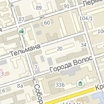
|
Normal
|
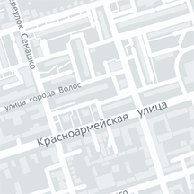 |
Schematic map based on vector data from Nokia (maps http://here.com). Default map.
|
|
Dark
|
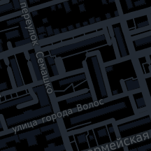 |
The map is similar to the "Normal" map with a changed color scheme (night).
|
|
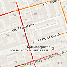
Gray
|
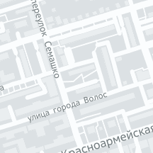 |
The map is similar to the "Normal" map with a changed color scheme (gray).
|
|
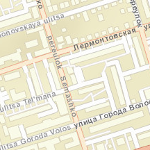
OSM
|
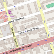 |
Schematic map based on data from the Open Street Map project. Has great accuracy in regions and additional information about buildings.
|
|
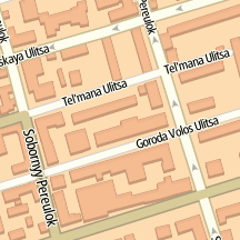
2Gis
|
 |
Schematic map based on vector data from the 2Gis system. Good detail in large cities, coverage only in Russia.
|
|
ArcGis
|
 |
English-language schematic map with relief overlay.
|
|
TomTom
|
 |
English-language map from TomTom.
|
|
Map
|
 |
Google map with traffic layer displayed.
|
|
Satellite
|
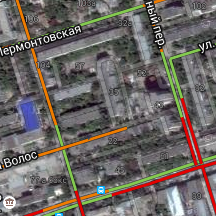 |
Google satellite map.
|
|
Cosmo
|
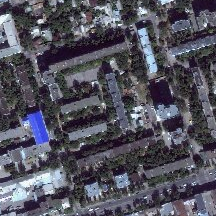 |
Satellite map with satellite image data.
|