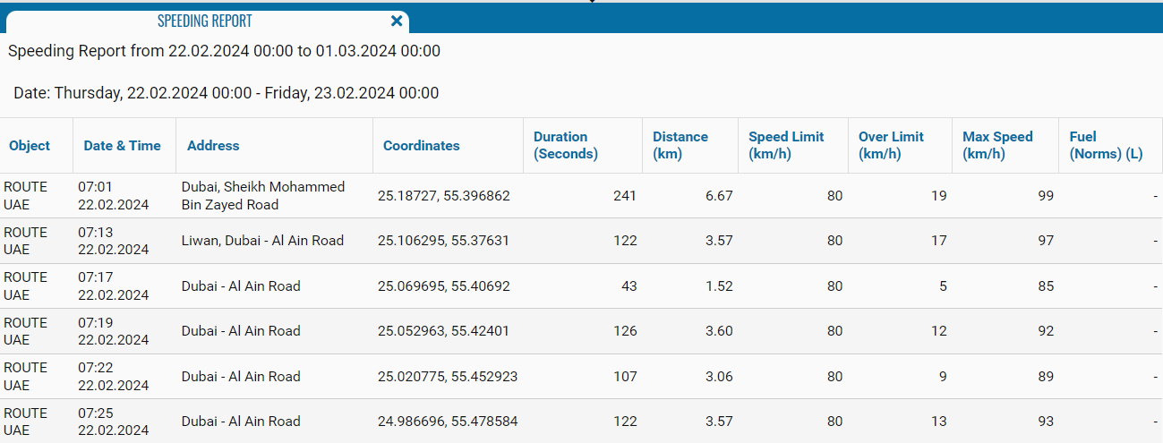
Speeding Report
The speeding report is designed to display data on speeding in the form of a table indicating the object, date, time, distance, limit value and exceeding the speed limit (max. speed), and the amount of fuel consumed.
The report contains:
• Date - the time period for which data is displayed.
• Object - monitoring object for which data is displayed.
• Date and Time - date and time when the speeding was recorded.
• Address - the address of the monitoring object where the speeding was recorded.
• Coordinates - latitude and longitude on Google Maps gps coordinates.
• Duration - the time during which the monitored object exceeded the speed limit.
• Distance, km - the distance over which the monitored object exceeded the speed.
• Speed control, km/h - maximum permissible speed (set in the object settings).
• Excess - the value by how much the speed was exceeded.
• Max. speed - maximum recorded speed.
• Fuel consumption - average fuel consumption per kilometer.
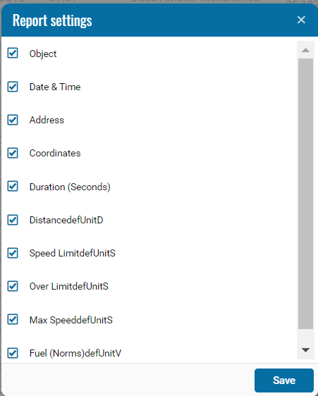
If necessary, you can disable certain parts of the report by clicking on the icon , when pressed, a menu opens where you can disable / enable certain fields.