Map and geocoding
Here you can configure:
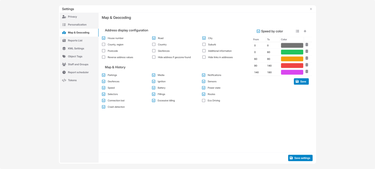
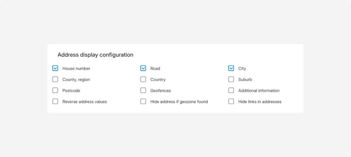
Choose which address components are shown in the system (for example, in reports or map tooltips).
-
Hide address if geofence found: the system will show only the geofence name if the address is within it
-
Reverse address values: display the address from country down to house number
How to set up:
-
In the Map & Geocoding tab, find the Address display settings section2. Review the list of address components3. Check the boxes for the components you want to show4. Click Save settings in the Map & Geocoding tabIn the Map & History section, you can choose which event types will be shown in an object’s history.
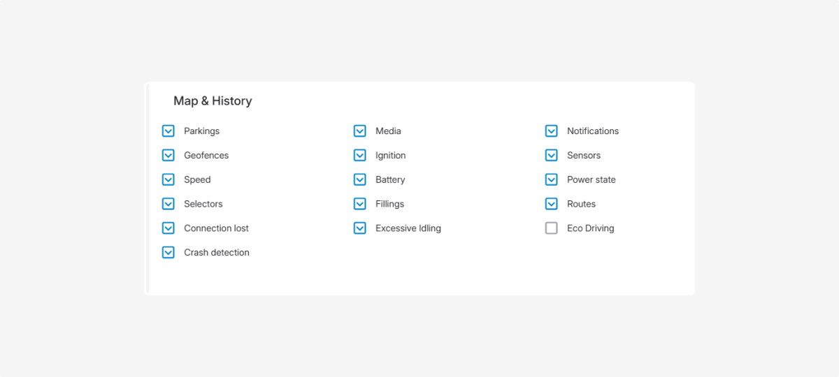
When you open the Events tab in the History section, you’ll see the event types you selected.
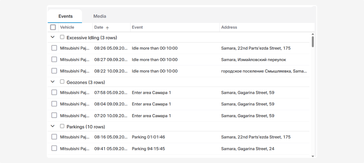
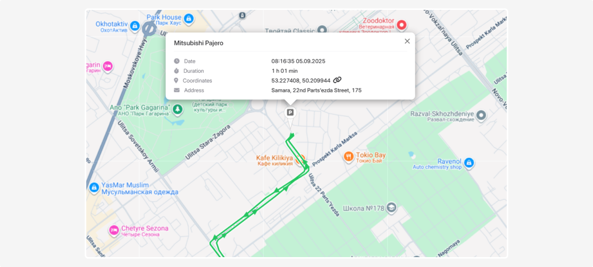
Markers will also appear on the map at the locations where these events occurred. For example, if you select Parkings and click a specific record, the map will highlight the exact place where it was recorded.
How to set up:
-
In the Map & Geocoding tab, find the Map & History section2. Select the event types to display in the object’s history — check the boxes you need.3. Click Save settings in the Map & Geocoding tab
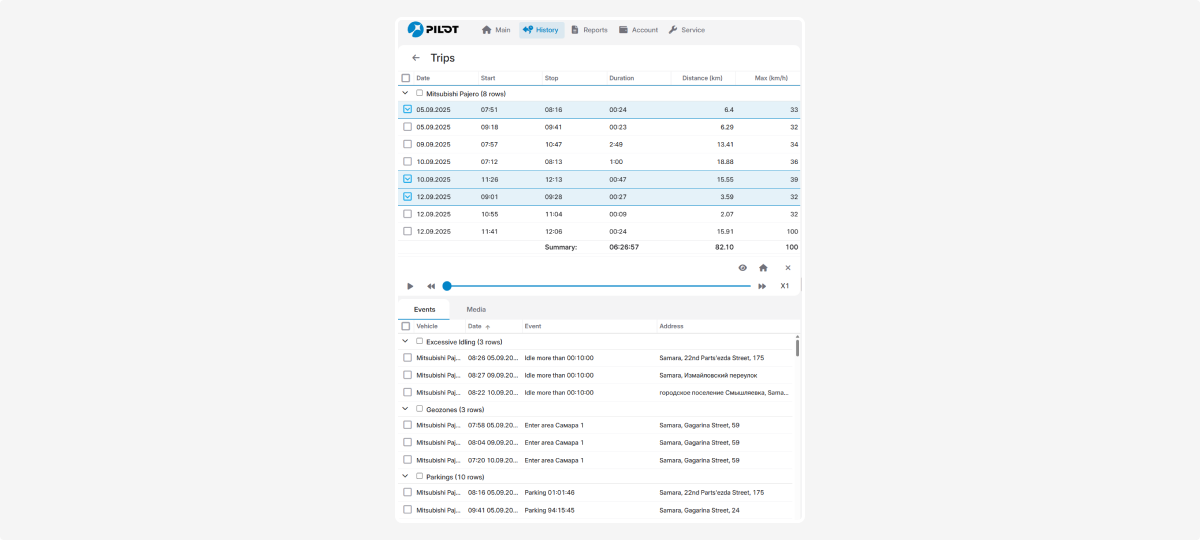
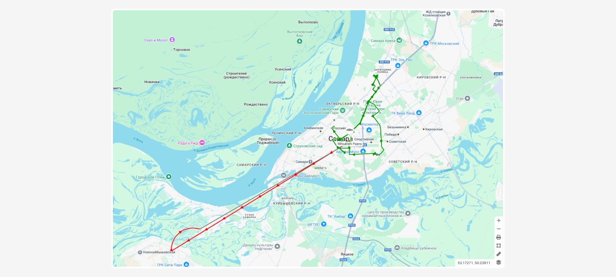
Speed color indicators show speed changes using different colors. On the movement track in History, you’ll see how fast the object was moving at each moment.
How to set up:
-
In the Map & Geocoding tab, go to the Speed by color section
2. Check Speed by color to display the track in color in History
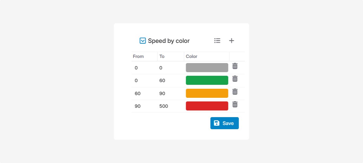
3. Default color legend  :
:
Gray — stopped
Green — slow driving up to 60 km/h
Orange — medium speed up to 90 km/h
Red — fast driving over 90 km/h
To change the default colors:
-
Double-click the color field you want to change2. Choose a new color
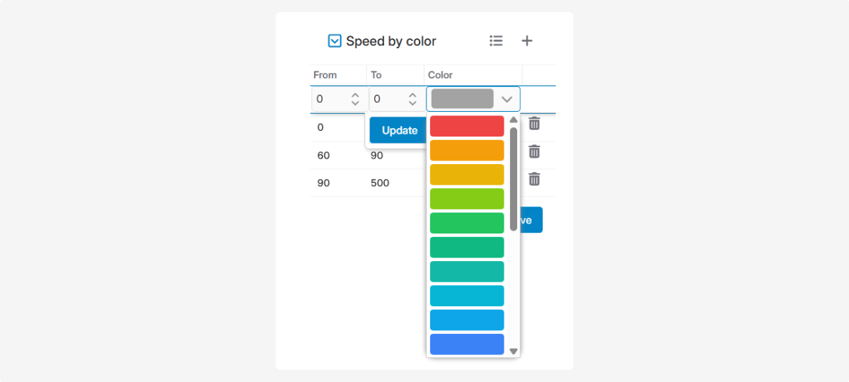
3. Click Update
4. Click Save in the Speed by color section
To add a new color band:
-
Click Add color

2. Choose the color and set the speed threshold
3. Click Save
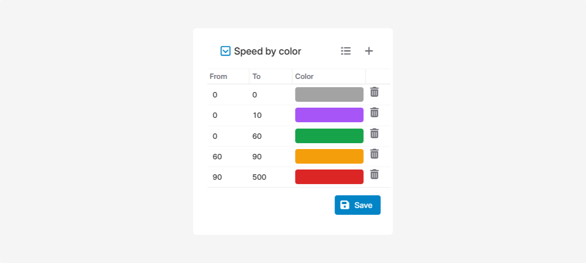
To delete a color band, click the delete icon  next to it.