KML settings
KML/KMZ is a file format that lets you add extra geographic data to the map:
— points
— lines
— areas (polygons)
— images
Think of it as a transparent overlay you place on top of the base map. It helps you show what you need: mark important objects, show boundaries, or draw routes.
The base map stays visible, and the extra information is layered on top.
You can upload a KML/KMZ file to PILOT and see the additional data on the map.
Where to get a KML/KMZ file:
-
Create it yourself:
-
In Google Earth
-
By editing a text file manually
2. Download ready-made files:
-
From specialized geodata websites
-
From open mapping databases
-
From professional communities and forums
How to upload a file to PILOT:
-
Open the KML Settings tab
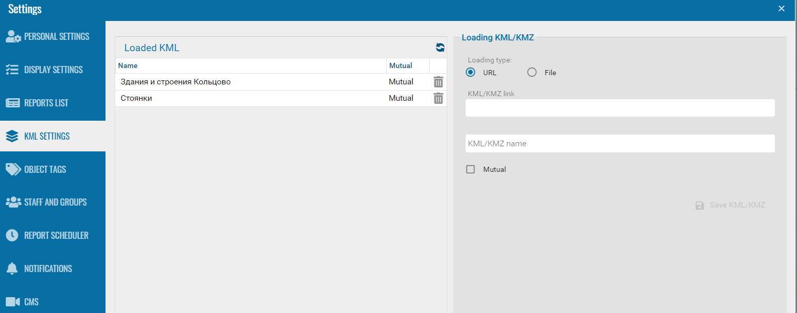
2. In the Loading KML/KMZ section, choose the source:
-
URL — if the file is on the internet
-
File — if the file is on your computer3. Paste the link or select the file4. Enter the file name that will be shown in PILOT
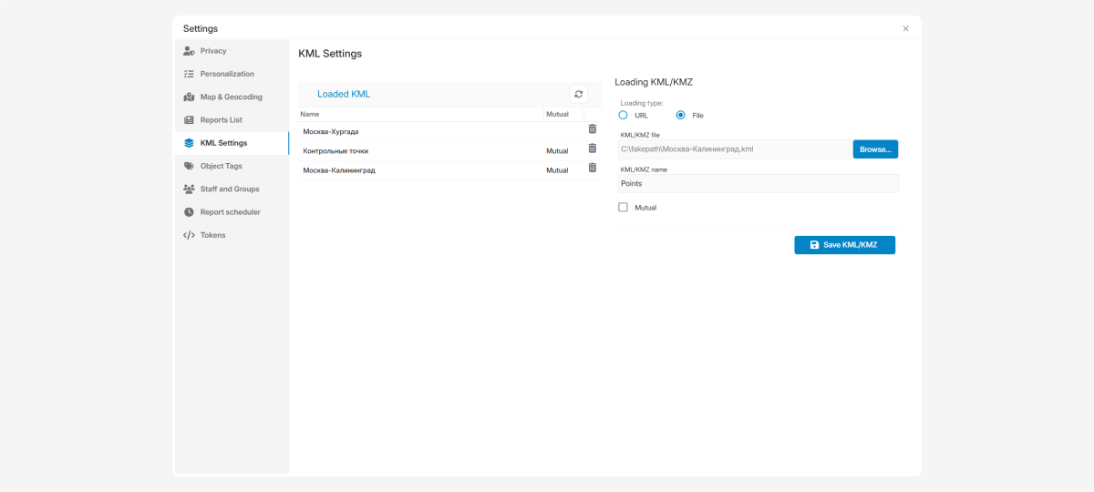
5. Click Save KML/KMZ
If you want all contract users to see the file, check Mutual.
To delete an uploaded KML, click the delete icon  next to it.
After uploading a KML file, the Object Layers tool will appear on the map.
How to display layers on the map:
-
Find the Object Layers panel — a list with checkboxes — in the top-right corner of the map
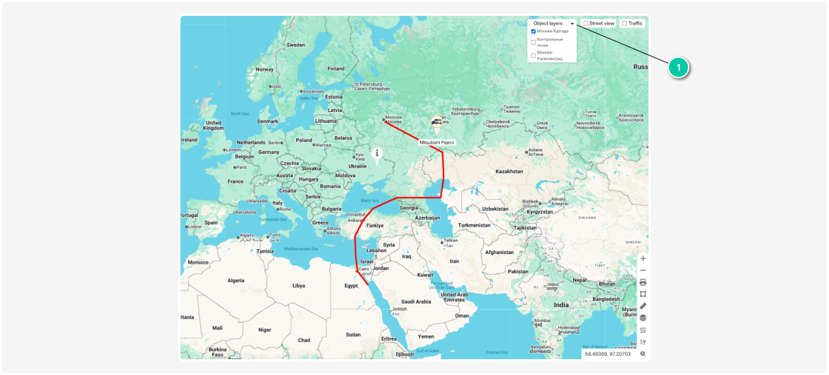
2. Expand the list and check the layers you want to show. You can select one or multiple layers at the same time
3. The selected layers will appear on the map while the base map remains visible